Mt Baker Tourism Information
Recreational Areas
SILVER LAKE PARK
9006 Silver Lake Rd
Maple Falls WA, 98266
(360) 599 – 2776
Playground – Swimming Area – Trails through out Park – Picnic Area
Silver Lake Park is a beautiful place to enjoy a family gathering outdoors with plenty of picnic tables and even grills, all right by the water. There is plenty to keep everyone happy between a playground for kids, a public swimming area as well as forested trails throughout the park. Silver Lake Park is only 20 minuets from Glacier, Washington.
RANGER STATION
10091 Mt. Baker Hwy
Glacier WA, 98244
(360) 599 – 2714
The Glacier Public Service Center on the Mt. Baker Scenic, Byway, State Route 542, serves visitors headed into the northern reaches of the Mt. Baker – Snoqualmie National Forest and North Cascade National Park.
Current operations include 24 – hour self – service outdoor information, restrooms, picnic tables and staffed visitor services on a seasonal schedule & Visitors can buy books, maps and other sales items including federal recreation passes.
HEATHER MEADOWS CAFE
Mt. Baker Ski Area
Heather Meadows Cafe is on the 2nd floor of the Heather Meadows Day Lodge near Mt. Baker in Washington State, USA. It’s open for the summer Friday to Monday, 11-5:30pm. Expect to spend $10-20 depending on your meal.
Waterfall Height: 88 feet
HEATHER MEADOWS VISITOR CENTER
Glacier WA, 98244
Open seasonally, Closed during winter months.
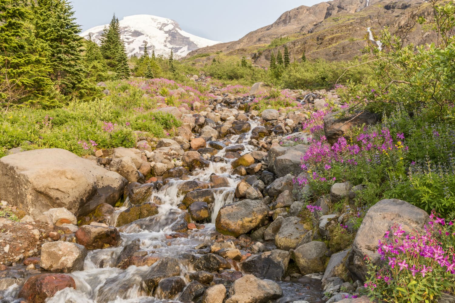
Heather and Huckleberry meadows dot the majestic landscape at Heather Meadows near the eastern end of the Mount Baker Scenic Byway, Washington State Route 542.
Glistening lakes nestle between knolls. Ridges bristle with 900-year-old mountain hemlock. Even the rocks catch the eye. Lava flows from Mount Baker have resisted glacial carving and columns of andesite stand like black anvils against the sky.
AUSTIN PASS PICNIC AREA
Glacier WA, 98244
Open seasonally, closed during winter months.
Located in Heather Meadows, this picnic area provides views of mountains, sub-alpine vegetation and occasional wildlife. Parking is abundant and includes spaces for large busses and RVs. The Heather Meadows Visitor Center and hiking trails for all abilities can be accessed from the picnic area.
Mt Baker Ski Area
Glacier WA, 98244
(360) 734 – 6771
Mt. Baker Ski Area is a ski resort in the northwest United States, located in Whatcom County, Washington, at the end of State Route 542. The base elevation is at 3,500 feet, while the peak of the resort is at 5,089 feet. It is about ten miles south of the 49th parallel, the international border with Canada.
Trails & Hikes
PICTURE LAKE PATH
Glacier WA, 98244
Distance: 0.4 miles
Elevation Gain: 6 feet
Route Type: Loop
Picture Lake Path is a 0.4 mile moderately trafficked loop trail located near Glacier and Maple Falls, Washington that features a lake and is good for all skill levels. The trail is primarily used for hiking and walking and is best used from June until November. Dogs are also able to use this trail but must be kept on leash.
BOYD CREEK TRAIL
Glacier WA, 98244
Distance: 0.5 miles
Elevation Gain: 50 feet or less
Route Type: Out & Back
This relatively new self-guided interpretive walk follows recently restored Boyd Creek, an important spawning habitat for members of the anadromous world. That’s salmon and trout to you and me. Signs along this forested, mostly boardwalk trail detail the life cycles of species such as chinook, pink, and coho salmon, as well as steelhead and cutthroat trout.
HUNTOON POINT VIA ARTIST POINT TRAIL
Glacier WA, 98244
Distance: 1.1 miles
Elevation Gain: 157 feet
Route Type: Loop
Huntoon Point Via Artist Point Trail is a 1.1 mile moderately trafficked loop trail located near Glacier and Maple Falls, Washington that features beautiful wild flowers and is good for all skill levels. The trail is primarily used for hiking, walking, nature trips, and birding and is best used from July until September. Dogs are also able to use this trail but must be kept on leash.
HORSESHOE BEND
Glacier WA, 98244
Distance: 1.5 miles
Elevation Gain: 250 feet
Route Type: Out & Back
Hike a gentle trail along a raging river. Perfect for evening and early morning strolls. Perfect for introducing children to the wonders of nature. Perfect for stretching your legs out on the way to Heather Meadows. Perfect for watching diving dippers and daring river kayakers. And perfect for staring into tumultuous rapids. But a terrible place for carrying on a conversation— the river’s roar is deafening, its allure oh-so intoxicating.
Despite being easy to walk, near a popular campground, and offering access to a spectacular wild river, Horseshoe Bend surprisingly is not a terribly busy trail. Don’t be stunned to find a handful of vehicles at the trailhead, however; the trail may be deserted, but the river may not be. This is a popular launch and take-out for river runners.
DAMFINO LAKES TRAIL
Glacier WA, 98244
Distance: 1.6 miles
Elevation Gain: 360 feet
Route Type: Out & Back
Damfino Lakes Trail is a 1.6 mile heavily trafficked out and back trail located near Maple Falls, Washington that features a lake and is rated as moderate. The trail is primarily used for hiking and walking and is best used from June until November. Dogs are also able to use this trail but must be kept on leash.
TABLE MOUNTAIN TRAIL
Glacier WA, 98244
Distance: 3.8 miles
Elevation Gain: 1,391 feet
Route Type: Out & Back
Table Mountain Trail is a 3.8 mile moderately trafficked out and back trail located near Glacier and Maple Falls, Washington that features a waterfall and is rated as moderate. The trail is primarily used for hiking, walking, trail running, and nature trips and is best used from July until October. No pets are allowed on this trail.
WINCHESTER MOUNTAIN TRAIL
Glacier WA, 98244
Distance: 2.9 miles
Elevation Gain: 1,299 feet
Route Type: Out & Back
Winchester Mountain Trail is a 2.9 mile moderately trafficked out and back trail located near Maple Falls, Washington that features a lake and is rated as difficult. The trail is primarily used for hiking and walking and is best used from June until November. Dogs are also able to use this trail but must be kept on leash.
CHAIN LAKES LOOP
Glacier WA, 98244
Distance: 5.6 miles
Elevation Gain: 1,820 feet
Route Type: Loop
Chain Lakes Loop Trail is a 5.6 mile heavily trafficked loop trail located near Glacier and Maple Falls, Washington that features a lake and is rated as difficult. The trail is primarily used for hiking, walking, nature trips, and birding and is best used from June until November. Dogs are also able to use this trail but must be kept on a leash.
HELIOTROPE RIDGE
Glacier WA, 98244
Distance: 5.9 miles
Elevation Gain: 1,988 feet
Route Type: Out & Back
Heliotrope Ridge Trail is a 5.9 mile heavily trafficked out and back trail located near Deming, Washington that features a waterfall and ends at the base of the glaciers of Mt. Baker, and is rated as difficult. The trail offers a number of activity options and is best used from March until October. Dogs are also able to use this trail but must be kept on leash.
TOMYHOI LAKE TRAIL
Glacier WA, 98244
Distance: 6.8 miles
Elevation Gain: 3,333 feet
Route Type: Out & Back
Tomyhoi Lake Trail is a 6.8 mile heavily trafficked out and back trail located near Maple Falls, Washington that features a lake and is rated as difficult. The trail is primarily used for hiking, walking, nature trips, and birding and is best used from April until November. Dogs are also able to use this trail.
YELLOW ASTER BUTTE TRAIL
Glacier WA, 98244
Distance: 6.8 miles
Elevation Gain: 2,522 feet
Route Type: Out & Back
Yellow Aster Butte Trail is a 6.8 mile moderately trafficked out and back trail located near Glacier, Washington that features a lake and is rated as moderate. The trail is primarily used for hiking, walking, nature trips, and birding and is best used from July until October. Dogs are also able to use this trail but must be kept on leash.
SKYLINE DIVIDE TRAIL
Glacier WA, 98244
Distance: 7.7 miles
Elevation Gain: 2,381 feet
Route Type: Out & Back
Skyline Divide Trail is a 7.7 mile heavily trafficked out and back trail located near Glacier, Washington that features beautiful wild flowers and is rated as difficult. The trail is primarily used for hiking, camping, birding, and backpacking and is best used from April until November. Dogs are also able to use this trail but must be kept on leash.
PTARMIGAN RIDGE TRAIL
Glacier WA, 98244
Distance: 7.9 miles
Elevation Gain:1,561 feet
Route Type: Out & Back
Ptarmigan Ridge Trail is a 7.9 mile moderately trafficked out and back trail located near Glacier, Washington that offers scenic views and is rated as moderated. The trail is primarily used for hiking and is best used from July until October. Dogs are also able to use this trail.
CHURCH MOUNTAIN TRAIL
Glacier WA, 98244
Distance: 8.2 miles
Elevation Gain: 3,789 feet
Route Type: Out & Back
Church Mountain Trail is an 8.2 mile heavily trafficked out and back trail located near Maple Falls, Washington that features a river and is rated as difficult. The trail is primarily used for hiking, walking, and trail running and is best used from June until October. Dogs are also able to use this trail but must be kept on leash.
GOAT MOUNTAIN TRAIL
Glacier WA, 98244
Distance: 8.2 miles
Elevation Gain: 4,242 feet
Route Type: Out & Back
Goat Mountain Trail is a 8.7 mile lightly trafficked out and back trail located near Maple Falls, Washington that features beautiful wild flowers and is rated as difficult. The trail offers a number of activity options and is best used from May until October. Dogs are also able to use this trail but must be kept on leash.
BOUNDARY WAY TRAIL
Glacier WA, 98244
Distance: 8.2 miles
Elevation Gain: 1,458 feet
Route Type: Out & Back
Boundary Way Trail is an 8.2 mile moderately trafficked out and back trail located near Glacier and Maple Falls, Washington that features a variety of terrain changes from forest to scenic meadow and is rated as difficult. The trail is primarily used for hiking, walking, nature trips, and birding and is best used from June until October. Dogs are also able to use this trail but must be kept on leash.
LAKE ANN TRAIL
Glacier WA, 98244
Distance: 9.3 miles
Elevation Gain: 2,575 feet
Route Type: Out & Back
Lake Ann is a 9.3 mile out and back trail located near Glacier and Maple Falls, Washington that features a great forest setting and lake, this hike is rated as moderate. The trail is primarily used for hiking and is best used from July until October. Dogs are also able to use this trail.
HANNEGAN PASS AND PEAK
Glacier WA, 98244
Distance: 12.5 miles
Elevation Gain: 3,582 feet
Route Type: Out & Back
Hannegan Pass Trail is a 12.5 mile moderately trafficked out and back trail located near Glacier and Maple Falls, Washington that features a waterfall and is rated as difficult. The trail is primarily used for hiking, walking, nature trips, and birding and is best used from June until October. Dogs are also able to use this trail but must be kept on leash.
HIGH DIVIDE TRAIL
Glacier WA, 98244
Distance: 13.0 miles
Elevation Gain: 5,930 feet
Route Type: Out & Back
High Divide trail is a 13 mile moderately trafficked out and back trail located near Glacier and Maple Falls, Washington that features outstanding views of outstanding views of Mt. Baker and the Nooksack Valley. This is one of the first trails to melt, making it a good early summer hike. The trail is primarily used for hiking, walking, nature trips, and birding and is best used from June until October. Dogs are also able to use this trail but must be kept on leash.
ARTISTS POINT LOOKOUT
Glacier WA, 9824
Distance: 13.0 miles
Elevation Gain: 5,930 feet
Route Type: Short walk
Artist Point Lookout has expansive views of the Northern Cascades located at a 5100 foot elevation that is fully accessible by road that terminates at a parking lot that will hold 200 cars. The road closes in the winter due to a substantial snowfall. The snow is trucked out in the summer (by July 4th) to permit vehicle access. Restrooms and picnic areas are located at the nearby Heather Meadows.
NOOKSACK FALLS
Glacier WA, 98244
Waterfall Height: 88 feet
Nooksack Falls is a waterfall along the North Fork of the Nooksack River in Whatcom County, Washington. The water flows through a narrow valley and drops freely 88 feet into a deep rocky river canyon. The falls are viewable from the forested cover near the cliffs edge.