Sitting just two and a half hours from the epicenter of Seattle is Mt. Baker-Snoqualmie National Forest. A vast and diverse landscape filled with stunning views straight from the packed dirt of Washington’s best hiking trails.
Most avid hikers hit the Washington highlights in Rainier National Park, Olympic National Park, or maybe, the North Cascades. But only those truly in the know follow the Mt. Baker Highway to the mountainous, often snow-rimmed wilderness.
From the slopes of Mount Baker itself to the ridgelines and snowfields in between, if you’re looking for epic panoramic views of mountains and a quintessential Pacific Northwest experience, you should be hiking on and around Mt. Baker and staying in one of our luxury cabins in Glacier.
About the Mt. Baker Area
There’s a smattering of small towns surrounding the awe-inspiring Mt. Baker area. Many are clustered near the Nooksack River, but for the most part, these are Washington’s most untouched landscapes. There are plenty of luxury rentals along Mt. Baker Highway, including many great options nestled in the town of Glacier.
The most popular time to catch amenable conditions in this area is between June and August.
These are the best hikes on and around Mount Baker for the Spring-Autumn seasons.
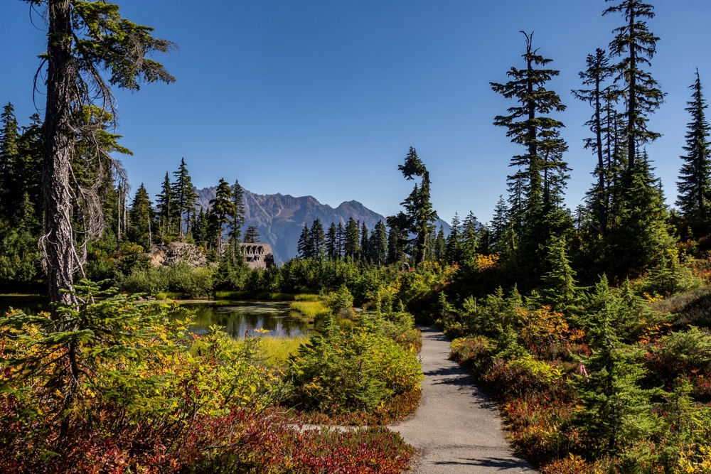
Picture Lake Trail
- Length: 0.5 miles
- Elevation Gain: 6 ft
- Trail Type: Out and Back
- Difficulty: Easy
It’s all in the name. This lake offers the most crystal clear reflection of Mt. Shuksan. Get here at sunrise or sunset for an even more impressive sight with the added sherbert-colored sky.
Technically less of a hike and more of a brisk walk to the viewpoint, it is an absolute must when visiting the Mount Baker area. This lake trail is found on the way to the Artist Point parking lot.
Getting to the Trailhead: Just follow Highway 542 East all the way until you see this iconic view outside your driver-side window, approximately 21 miles outside the town of Glacier. Not accessible in the winter months.
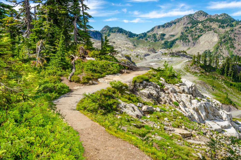
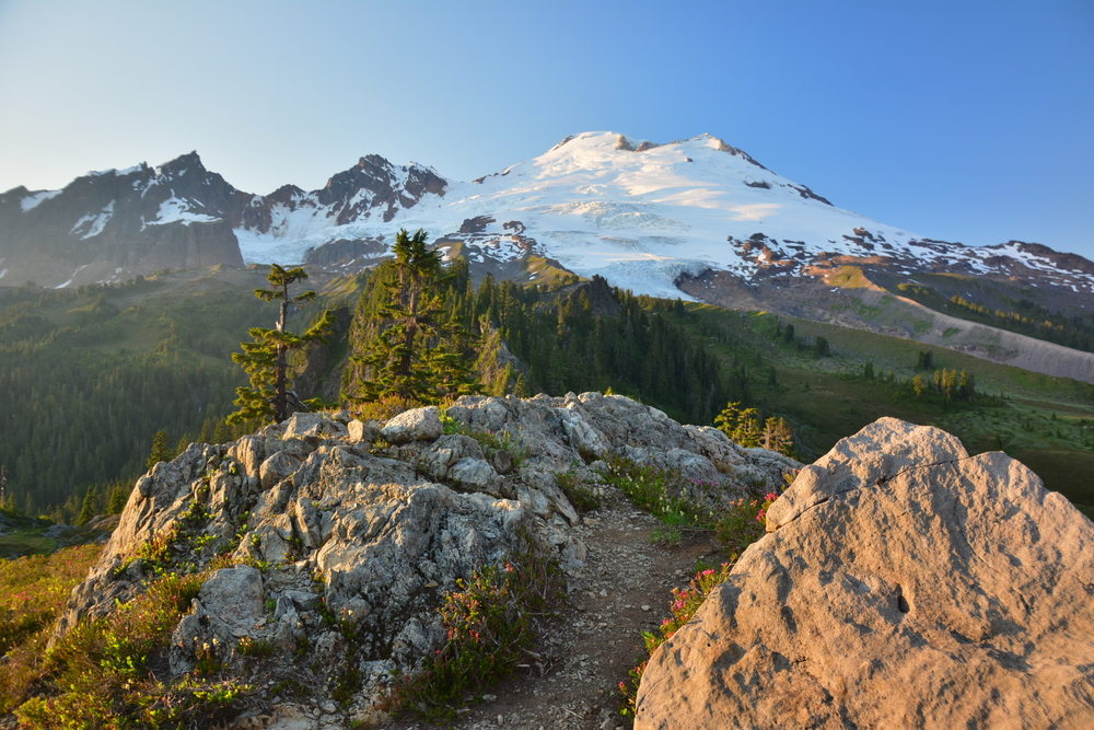
Artist Ridge Trail
- Length: 1.2 miles
- Elevation Gain: 200 ft
- Trail Type: Out and Back
- Difficulty: Easy
- Dog-friendly as long as they are leashed
A short and sweet hike perfect for all ages and physical abilities. This one makes you feel on top of the world.
Straight from the parking lot of Artist Point, you’ll feel like you can reach out and touch the rocky peaks of Mt. Shuksan and Mount Baker. A fair warning, due to its accessibility and popularity, this area can be extremely crowded during the summer and early fall months. Don’t let this deter you from some of the best views western Washington offers!
Arrive here early or later in the evening to avoid the crowds and to enjoy a sunrise or sunset that puts on a magical display of peachy hues painted across the boundless sky. During the summer months, wildflowers are on full display and are a birdwatcher’s paradise.
Getting to the Trailhead: The trail is marked and easily accessible from the Artist Point parking lot at the end of the Mount Baker Scenic Highway. Not accessible in the winter months.
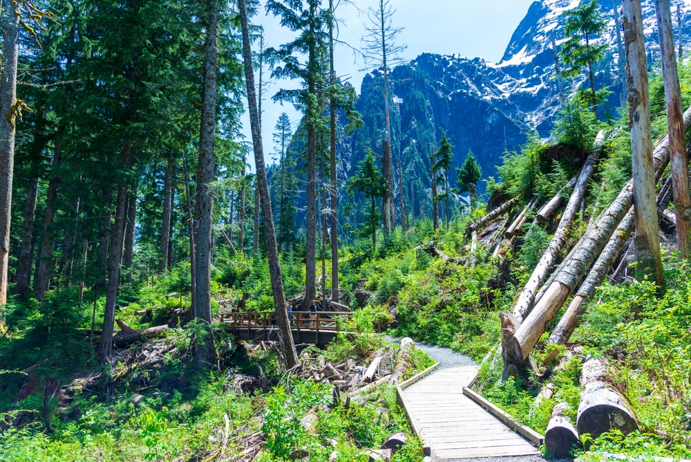
Big Four Ice Caves
- Length: 2.3 miles
- Elevation Gain: 311ft
- Type: Out and Back
- Difficulty: Easy
- Dogs on Leash, Kid-Friendly
Have you ever seen a cavern made of pure ice? If the answer is no, look no further than the Big Four Mountain Ice Caves.
Every year around late July, an amazing spectacle of snowmelt, avalanche debris, and warm winds creates these vast cathedrals of ice. The trail itself is easy and safe for the entire family.
Make sure to heed the warning signs and admire from the designated viewpoints because the areas in and around the caves can be hazardous and avalanche prone. Although this hike can be reached easiest in the summer months, it’s also a great area to explore with snowshoes and mini spikes during the winter.
This is one of the few hikes that are accessible year-round.
Getting to the Trailhead: To see the ice caves from Granite Falls, WA take the Mountain Loop Highway eastward for 26 miles, and the trailhead is on your right. Another option is to start the hike from Big Four Picnic Area a half mile (west) before the trailhead.
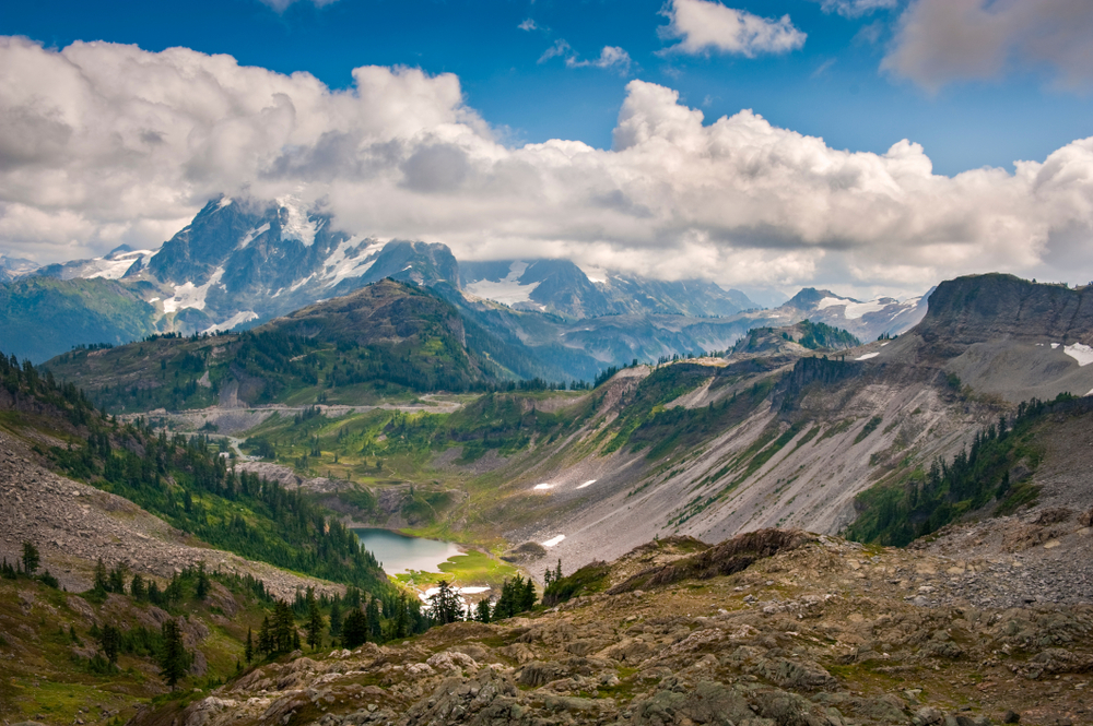
Bagley Lakes Loop
- Length: 2.2 miles
- Elevation Gain: 259 ft
- Trail Type: Loop
- Difficulty: Easy
To get the heart rate up a bit more, set out to enjoy the alpine scenery and the azure waters of Bagley Lakes. This loop is perfect for avid hikers and families.
Pass by waterfalls, lakes, and wildflowers surrounded by mountain views. If you’re feeling bold, you can even submerge yourself in the frigid waters for a quick rest before hiking on.
During the fall months, this hour-long hike explodes with fiery fall foliage and is worth adding to any leaf-peepers bucket list. To make this more of a challenge, you can connect this hike with the Chain Lakes Loop.
Getting to the Trailhead: The access to this trail is also found at the end of Highway 542, near Picture Lake.
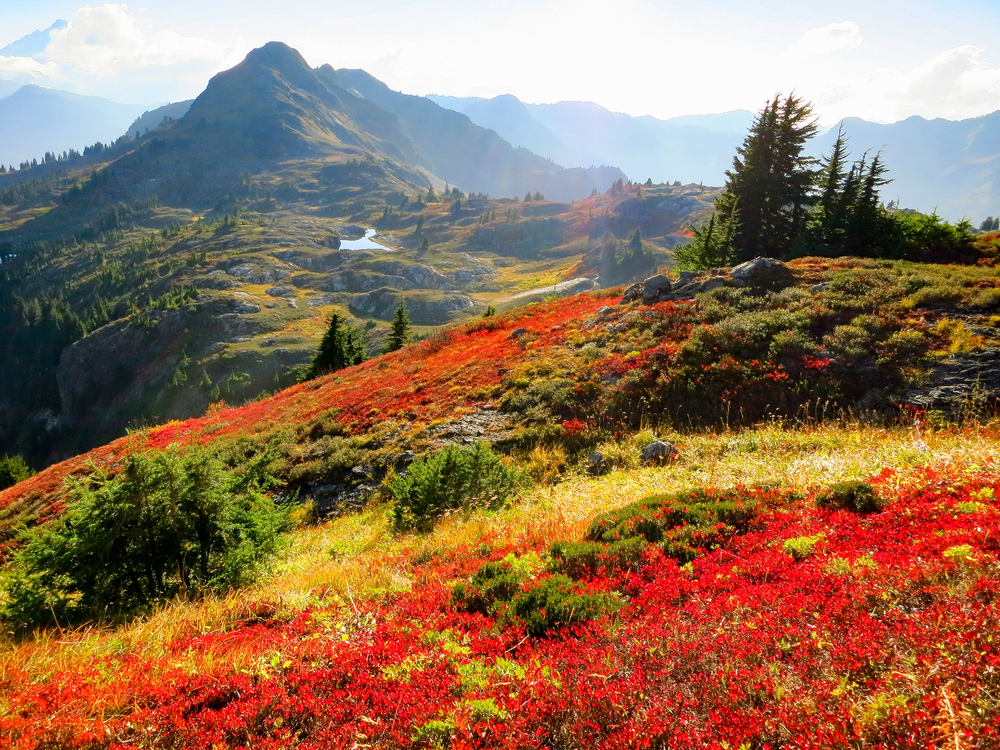
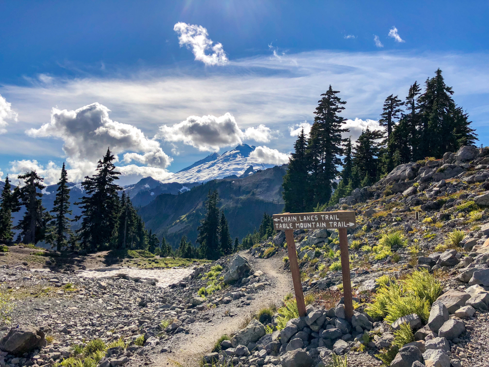
Chain Lakes Loop
- Length: 6.5 miles
- Elevation Gain: 1,820 ft
- Trail Type: Loop
- Difficulty: Moderate
- Dogs on leash permitted.
This doozy of a trail is perfect for those looking to challenge themselves. Don’t let the elevation or distance intimidate you, though. The Chain Lakes Trail is one of every Washingtonian’s favorite hikes, and it doesn’t take too much physical endurance to reap the rewards.
Ascend over heather meadows, along glasslike alpine lakes, and bask in the surrounding views of the North Cascades. A day hike you can achieve in 4 hours or so, depending on how captivated you get by your surroundings.
Like most, the best time of year for this hike is June through early October before snowfall closes the highway access.
Getting to the Trailhead: Although accessible from a few parking lots, an insider tip is to start at Artist Point so that by the time you get to the lakes, you’re ready to dive in and give your muscles that much-needed cool down from the elevation gain.
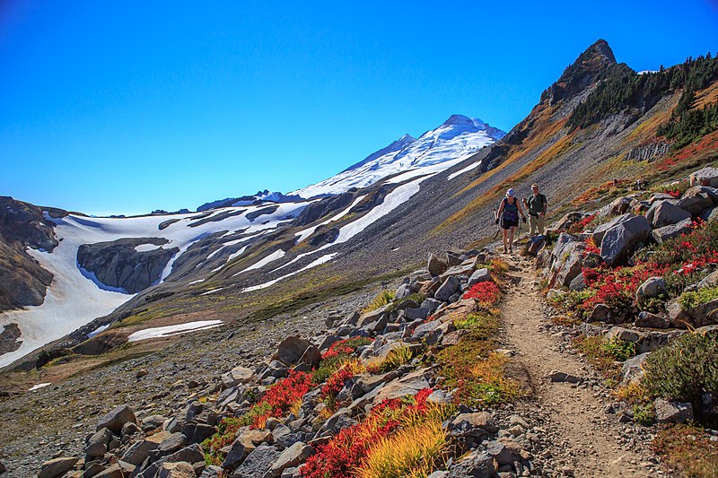
Yellow Aster Butte Trail
- Length: 7.5 miles
- Elevation Gain: 2,550 ft
- Trail Type: Out and Back
- Difficulty: Difficult
- Dogs on leash permitted.
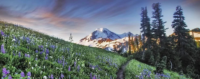
A highly recommended trek for experienced hikers. This trail will leave you dazzled by fiery autumn foliage, but it’s not to be avoided in late spring or summer when vivid wildflowers bloom through the vast meadows and an avalanche pass.
Yellow Aster Butte Trail earns you panoramic views and brilliant nature up here. This trail is challenging, with an elevation gain of 1,500 feet in the first mile. Once you’ve reached the top, though, you’ll find yourself gazing eye to eye with the peaks of the North Cascade range.
Getting to the Trailhead: Follow Highway 542 to Twin Lakes Road (forest road #3065), where you turn left and look for the Tomyhoi Lake/Yellow Aster Butte trailhead, about five minutes down the road.
Park Butte Lookout
- Length: 7.5 miles
- Elevation Gain: 2,200 ft
- Trail Type: Out and Back
- Difficulty: Moderate
- Dogs on leash permitted.
Perched at the top of this path awaits a fire lookout. A perfect reward for those burning thighs. Park Butte Lookout is highly recommended and accessible for anyone willing to tough out a heart-pumping albeit nontechnical incline. The tower was built in 1932 and is still maintained, thanks to the Skagit Alpine Club volunteers.
Be sure to bring an appetite because you’ll be walking through huckleberry bushes with semi-overgrown trail conditions before your final push to the top. To reach the lookout, you will have to climb a ladder, but the views of the Twin Sisters and near constant view of Mount Baker itself are irresistible.
The hike itself can take upwards of four hours to complete, and dogs on leashes are permitted but do keep in mind you may encounter horseback riders sharing the trail as well. Park Butte trail is only accessible from July-October.
Note: This hike is found on the southern side of Mount Baker near Baker Lake. Opposite most hikes on this list. You won’t be coming from the Mount Baker Scenic Highway for this hike.
Getting to the Trailhead: Take State Highway 20 east to County Road 11, take this road north to County Road 12, turn right onto County Road 13 and follow to the trailhead.
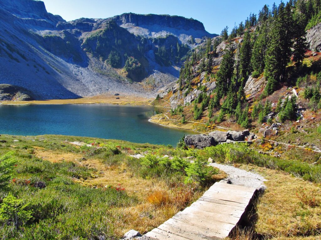
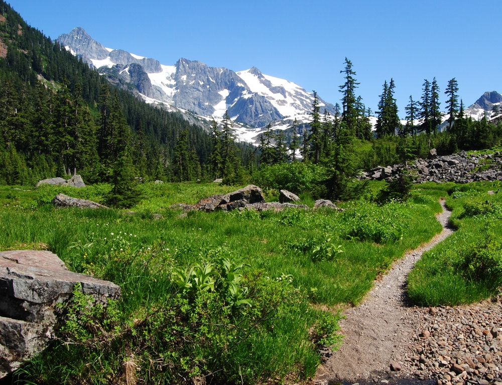
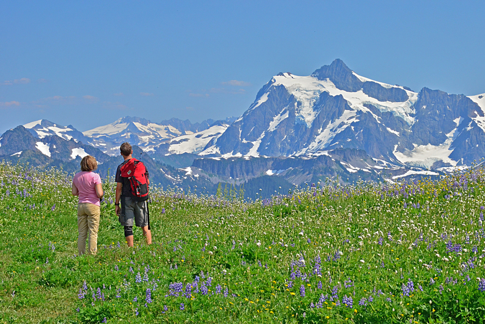
Lake Ann Trail
- Length: 8.2 miles
- Elevation Gain: 2,017 ft.
- Trail Type: Out and Back
- Difficulty: Moderate/Difficult
The Lake Ann trail checks all the boxes when it comes to epic Washington hiking. Meadows, talus slopes, glistening tarns, alpine forest, and of course, uninterrupted views of the Curtis glacier and Mt. Shuksan.
The trail condition is deemed moderately difficult due to some shifty ground along the rocky areas of the path so watch your footing. The Lake Ann Trail starts off in the cool wooded area and descends two miles into a lush meadow before rising 1000 feet to the saddle above Lake Ann.
Also, be on the lookout for wildlife and the distinct call of the stuffed animal-like pikas and marmots that perch themselves along the larger boulders. Once in a while, you can even hear the thunderous cracking of ice calving from the glaciers above and the distant roaring of waterfalls.
The best time for this hike is July through early October but be sure to always check for road closures due to snow in the shoulder months.
Getting to the Trailhead: The road to get here will take you east on Highway 542 from Bellingham to the Mt. Baker Ski area, and look for the Austin Pass Trailhead. Parking is on your left-hand side.
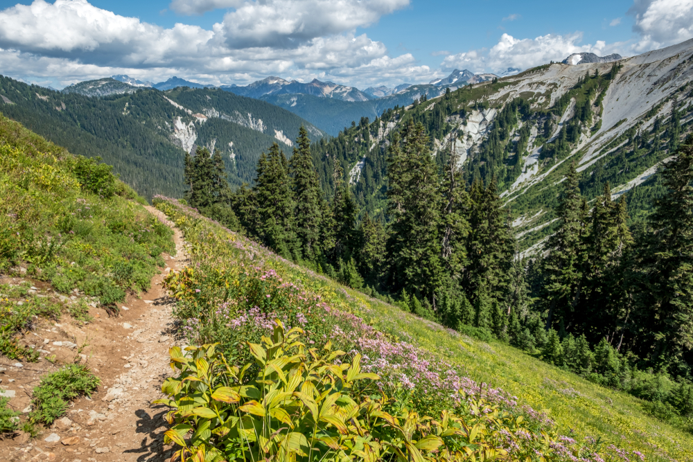
Ptarmigan Ridge Trail
- Length: 11.6 miles
- Elevation Gain: 2400 ft.
- Trail Type: Out and Back
- Difficulty: Moderate/Difficult
- Dogs on leash permitted.
This beast of a hike is not for the faint of heart and takes around 5.5 hours for the average trekker. Although the specs seem daunting, the gradual incline, and the scenery is enough to motivate you.
About a mile in at the trail junction, you will head straight toward Ptarmigan Ridge. Twisting along blueberry patches up toward the rocky alpine pastures, you’ll face intimate views of Coleman Pinnacle and Mt. Baker.
Be aware that this trail has little to no shade and is very exposed. Pack extra water, sunscreen, and protective clothing from the UV rays. Be sure to look for the vibrant green waters of Goat Lake as you rest up and soak in the views before your descent back to the trailhead.
Getting to the Trailhead: The rocky path of Ptarmigan Ridge Trail is reached by parking in the Artist Point parking lot from the Chain Lakes Trailhead.
Skyline Divide
- Length: 7.2 miles
- Elevation Gain: 2,401 ft.
- Trail Type: Out and Back
- Difficulty: Moderate/Difficult
Equally as difficult to reach the trailhead as it is to hike, this challenging thigh burner requires not only strength and hydration but also a high-clearance vehicle. The road to get here is a long and bumpy, white-knuckled adventure and known to wash out from time to time, so be sure to check the road conditions.
If you’ve made it to the trailhead, now prepare to be basked in sunshine. Walk along high alpine meadows full of wildflowers as you climb seemingly into the sky itself.
The hike starts off a gradual steep incline for a couple of miles through a forest of hemlock and fir until you reach the clearing and are greeted with the most picturesque views of Kulshan and Shuksan peaks you can imagine.
Mile after mile upward creates new landscapes as wildflowers turn to fireweed and eventually into rocky terrain. The top of the sixth hill will leave you out of breath but instantly recharged with the panorama.
Getting to the Trailhead: Take State Highway 542 a mile east of the town of Glacier, onto Forest Road #39 (Glacier Creek Road), and turn immediately left onto Forest Service Road #37 (Deadhorse Road) and follow for 13 miles to the trail parking lot.
Heliotrope Ridge Trail
- Length: 5.9 miles
- Elevation Gain: 1,988 ft.
- Trail Type: Out and Back
- Difficulty: Challenging
- Dogs on leash permitted.
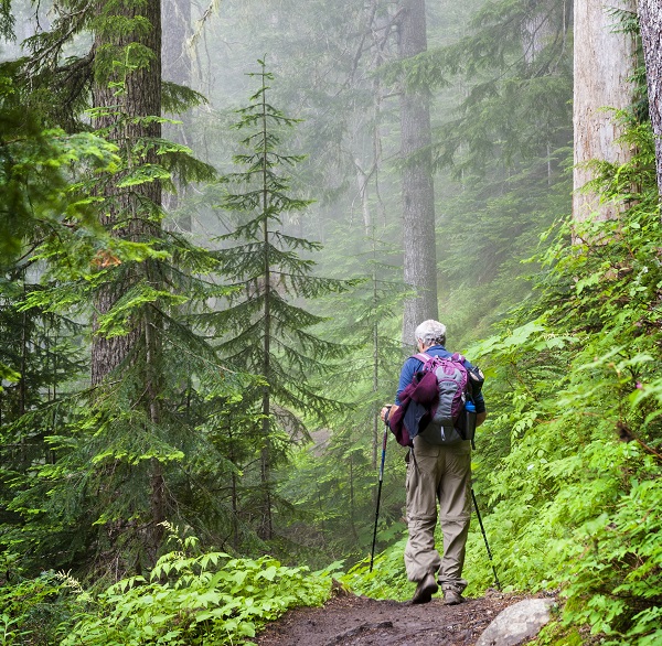
The Heliotrope Ridge Trail will bring you face-to-face with the Coleman glacier while it’s still here. While it may seem easy at only 5.9 miles, the elevation gain is significant and, on average, takes about four hours to complete.
You’ll start the hike in old-growth forests and end up high above the tree line. Some streams are to be crossed, and the top gets somewhat rocky, so watch your footing. For experienced mountaineers, it is possible to arrange a multi-day backpacking trip on the glacier, taking the famous Coleman Deming Route with a guide and a small group from late May to August.
Getting to the Trailhead: Travel east on Highway 542 from Glacier, WA, to Glacier Creek Road #39, turning right on Forest Road #39. Follow this road for 8 miles, and parking is on the left. Always remember to check for road closures before you disembark.
Hannegan Peak Trail
- Length: 10.4 miles
- Elevation Gain: 3,159 ft.
- Trail Type: Out and Back
- Difficulty: Difficult
- Dogs on leash Permitted.
As daunting as this grueling hike seems, those who deem themselves up to the task will be deeply rewarded.
The trail gradually ascends through wooded forests and small waterfalls upwards into unrelenting switchback after switchback until finishing in a grande crescendo of 1,000 feet of gain in the last mile.
After you pat yourself on the back for completing this doozy of a trek, you can reward yourself with a lunch break at the most spectacular views you can imagine. All being said, this trail can take up to 6 to 6.5 hours so bring plenty of water and snacks to keep you fueled up and hydrated along the way.
Getting to the Trailhead: Drive east on Highway 542 from Glacier for 12.5. miles to Road #32 (Hannegan Pass Road) on your left. Take this for 5 miles to the end of the road where parking and toilets are available.
Table Mountain Trail
- Length: 2.8 miles
- Elevation Gain: 692 ft.
- Type: Out and Back
- Difficulty: Moderate
- Strictly no pets allowed.
For a quick, albeit steep, trek, Table Mountain is easily accessible from the Artist Point parking lot.
Exposed on one side with steep switchbacks to the top means that pets are not permitted, and children should reconsider the hike. Once you’ve arrived at the tabletop-like summit on a clear sunny day, you can gander at the views of mountain peaks and the Chain Lakes below.
This hike only takes 1.5 hours, meaning optimal time to relax at the top, enjoy the display of mountain peaks before you and bask in nature.
Getting to the Trailhead: This hike is accessible from the Artist Point Parking Lot.
Winchester Mountain
- Length: 3.9 miles
- Elevation Gain: 1,299 ft.
- Trail Type: Out and Back
- Difficulty: Moderately Difficult
- Dogs on Leash permitted.
If you’re willing to tough out a steep, narrow road and have the proper vehicle, the bumpy ride to reach this trailhead is worth it. It’s a rare occurrence that the road is more difficult than the hike itself.
Keep in mind, though, the more difficult a trail is to reach, the more solitude you’ll find on the path. That being said, the pathway here leads you from blueberry bushes up to an incredible viewpoint.
Here you will be surrounded by 360-degree views of Mt. Baker, Mt. Larrabee, and Tomyhoi Peak, and below them are Twin Lakes’s translucent waters. If Park Butte Trail is a bit too arduous, this is another chance to experience an old fire lookout tower, a staple of mountain peak hiking in the Pacific Northwest.
Getting to the Trailhead: Follow Highway 542 east to Forest Road #3065 (Twin Lakes Road). Turn left just after the Department of Transportation Shuksan maintenance facility.
Follow Twin Lakes Road for four and a half miles until you come to where the road ends near the Yellow Aster Butte trailhead.
You can continue with 4-wheel drive, high clearance vehicles or set off on foot from here if you don’t mind adding extra mileage to the hike. Always check road conditions before you head out.
Mt. Baker is Packed With Bucket List Hikes
These fourteen hikes on and around Mount Baker epitomize the best of the Pacific Northwest. Mount Rainier gets all the attention in Washington State, but each of these hikes has more serenity and isolation than those in other popular National Parks.
The immaculate wilderness isn’t the only thing worth noting in this area. Choose a mountain retreat from one of these luxury vacation rentals for the best place to start and end your adventure.
Featured Image Credit: Galyna Andrushko